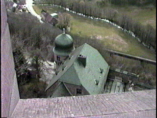
SURVEYING THE COUNTRY SIDE AND THE VILLAGE FROM THE UPPER CASTLE
 After 1444, the Dukes of Zweibrucken took over the Fortress
and held it until 1792. In 1792, the French occupation forces held it until 1814.
The Dukedom Sachen Coburg-Gotha held it from 1816 until 1834 when it came under the control
of Prussia. It was under the II & III Reich until 1945. Since 1971, it has been under the local county government of Kusel.
 The castle-fortress is currently being reconstructed on a massive scale.
Today, even the oldest buildings are being resurrected and restored with
a modern interior and historical exterior.
 The view looks south to the town of Kusel. This is a rural area of Germany
and most of the land is farmed. Off in the distance is Ramstein Air Base. This is a NATO air base
where many thousands of Americans and thousands of other NATO nationals live, defending the Western alliance.
 The view looks north to the high plateau of the Hunsruck. This is wild hunting and fishing
country today. Baumholder Army Base is off in the distance here. It is a large NATO ground-forces training
area. It was once a German SS base. It too, has hundreds of NATO nationals defending the Western way of life.
So as we leave the Fortress Burg Lichtenberg, we should see that this area has a long past and current history
with the forces of defense!
RETURN TO Fortress Table of Contents Page
RETURN TO Master Links